Tasmania’s history books are filled with colourful and dramatic chapters. Dozens of carefully preserved historical locations across the island tell their story of Tasmania’s important role in the birth of the Australian society we know today.
To experience Tasmania is to experience the story it has to tell: Aboriginal settlement, European discovery, harsh colonial conditions and the teething pains of an early Australian society. Compelling recollections of survival, despair and promising beginnings echo throughout stone and wood buildings across the state.
 Want to experience early Australian history? Listed below are 25 of Tasmania’s most interesting historic destinations, all waiting to tell their story.
Hobart Town
Early photograph of Hobart Town. Date unknown. Image courtesy of the Tasmanian Archive and Heritage Office. No AB713-1-5433
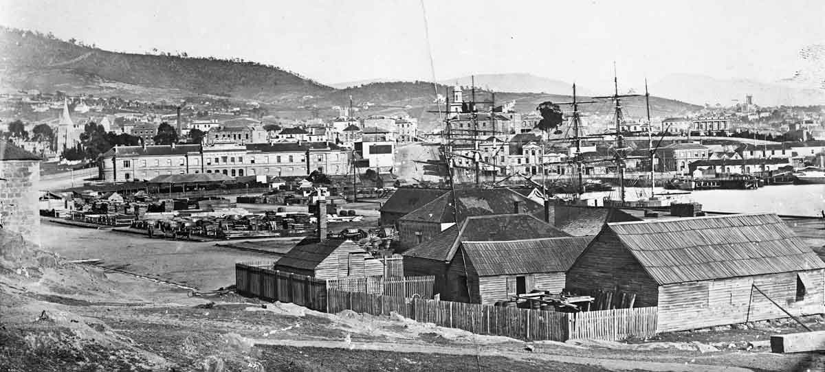
Tasmania’s history trail begins in Hobart, the capital and economic centre of the state. To overcome the problem of overcrowding in British prisons, the British Government chose Australia as the location for a new penal colony. The southernmost island of Tasmania (known as Van Diemen’s Land at the time) was chosen for geographic reasons, but also because the British wanted to establish their authority over the island and prevent French invasion.

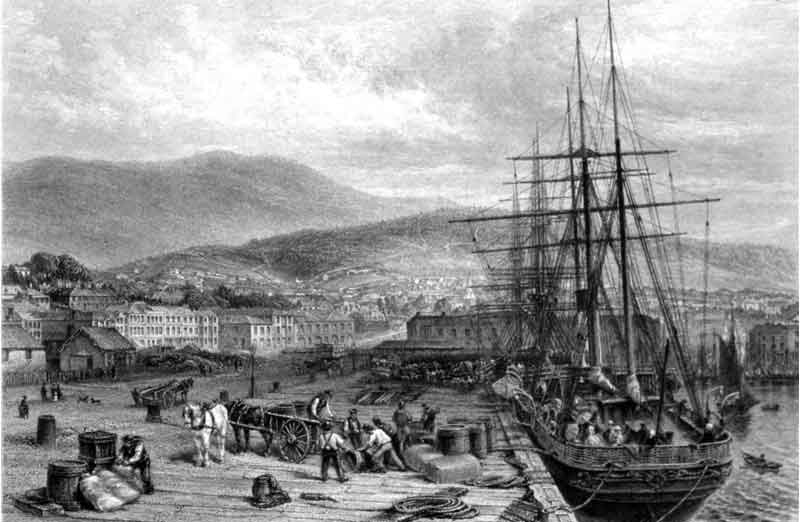
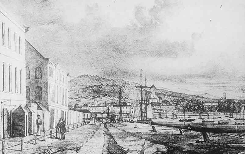
The Quay – Hobart Town. Dated between 1874 and 1876. Image courtesy of the Tasmanian Archive and Heritage Office.
The first penal colony of the island was established at Hobart Town in 1804 under the command of Lieutenant Governor David Collins. The colony consisted of convicts, free settlers and marines and was named “Hobart Town” after the Secretary of State for Wars and Colonies, Lord Robert Hobart.
Courthouse, barracks, hospital and markets were constructed under Governor Macquarie administration, many of which can still be explored. To build Hobart, the skills and expertise of convicts were utilized and thus emerged intrinsically beautiful structures such as the Hobart Waterfront and the Commissariat’s Store.
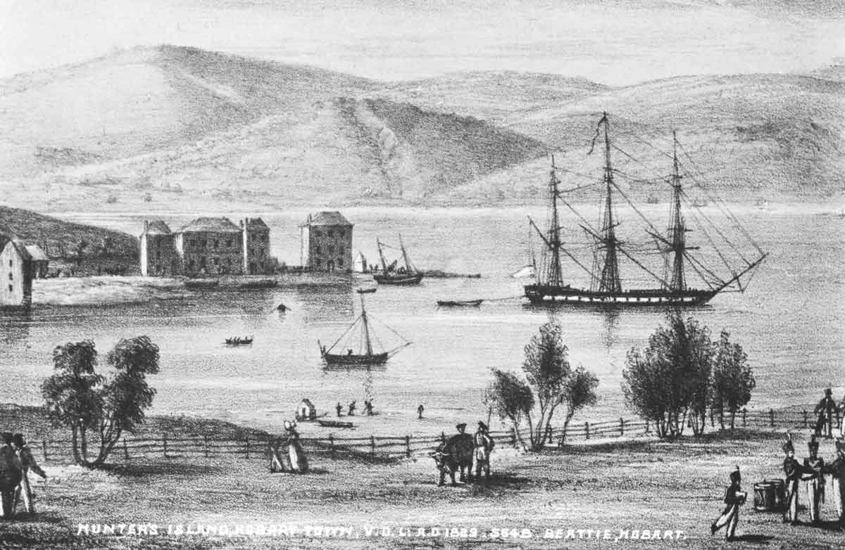
Hunters Island, Hobart Town 1829. Image courtesy of the Tasmanian Archive and Heritage Office. No NS1013/1/1876
Today these buildings and a host of other Georgian and Victorian sandstone structures provide the best opportunity to explore the history of Hobart.
Key places of historical significance in Hobart:
- Old Penitentiary Historic Site (Campbell Street)
- Angelsea Barracks (Davey Street)
- Parliament House (Davey Street)
- Customs House Hotel (Murray Street)
- The Old Court House (Murray Street)
- St Joseph’s Church (Macquarie Street)
- Tasmanian Museum and Art Gallery (Macquarie Street)
- Theatre Royal, the oldest theatre in Australia (Campbell Street)
Click here to see our range of DVDS available for purchase featuring Tasmania’s History.
Salamanca Place
A Sketch of Sa,amanca Place c1844. Image courtesy of the Tasmanian Archive and Heritage Office. No PH30-1-447
Address: Salamanca Place, Hobart, 7000
Salamanca Place is a series of elegant Georgian warehouses constructed in the 1830s to store grain, whale oil, imported goods, timber and grains. Located near the waterfront, Salamanca is one of the most widely recognised landmarks in Hobart and consists of galleries, bars, restaurants, cafes and shops.
By the mid 1900s, local industries like whaling had fallen into decline and the area fell into neglect. In the 1970s, the Tasmanian government conducted a heritage campaign to restore and revive the historical buildings, and the warehouses of Salamanca Place were transformed into the hub of cultural activity we know and experience today.
Early Salamanca and Hobart Wharf. Image courtesy of the Tasmanian Archive and Heritage Office. No NS1013-1-1001
Every Saturday, Salamanca Place is the venue of the world famous Salamanca markets where over three hundred stalls display Tasmania arts, crafts, antiques and fresh produce. Salamanca place is an ideal place to enjoy a cup of coffee and experience Tasmanian culture in its finest form.
Things to do at Salamanca Place
- Experience Salamanca markets every Saturday morning
- Visit Knopwoods Hotel for a pint of Tasmanian beer or wine
- Wander around the waterfront
Battery Point
Early Battery Point, Hobart. Image courtesy of the Tasmanian Archive and Heritage Office. No NS73-1-1-8
Address: Battery Point, Hobart, 7004
Battery Point is one of the oldest historical areas in Hobart and originally housed the early settlers and sailors of old Hobart Town. Battery Point is known for its European street design, cobbled pavements and sandstone houses ranging from simple cottages to elegant Georgian style homes. Once a run-down and neglected part of Hobart, Battery Point is now a thriving and upmarket suburb filled with cafes, galleries and homes of the ‘who’s who’ of Tasmanian society.
The small suburb gains its name from a battery of guns known as the Mulgrave Battery, installed in 1818 to defend the port of Hobart.
Battery Point is a stones throw away from Salamanca Place and can be accessed either by a historical flight of steps known as Kelly’s Steps or by following the road around from Salamanca Place.
Things to do at Battery Point
- Visit Kelly’s stairs (entrance can be found along Salamanca Place) and literally take a walk back through time along the cobbled pavement
- Walk down Hampden Road and witness lovingly restored whaler’s cottages
- Enjoy a Tasmanian Beer at the Shipwright’s Arms hotel, an iconic Tasmania watering hole
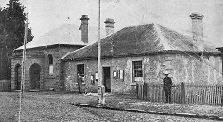
Campbell St. Gaol
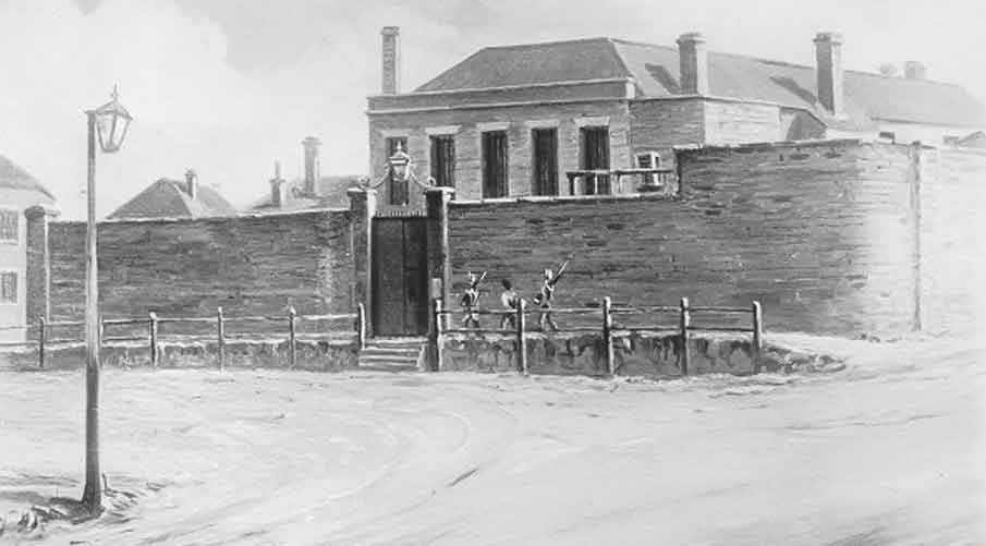
Old Hobart Gaol. By courtesy of the Archives Office of Tasmania No AB713-1-5808
Address: Corner of Brisbane & Campbell Streets, Hobart 7000
Campbell Street Gaol was constructed in Hobart Town in 1821 as a barracks and maximum security prison to accommodate convict prisoners until they were assigned to work gangs, settlers or sent to penal stations. The gaol’s location was chosen to allow for the simple transfer of convicts from their ships on the waterfront.
The central building was designed by an Irish Colonial Architect John Lee Archer and was based on a commonly used Georgian Renaissance style. In 1829 Archer designed a chapel next to the barracks and was specifically instructed to add solitary cells under the chapel floor to accommodate prisoners. These cells can be witnessed today, on a guided tour of the gaol.
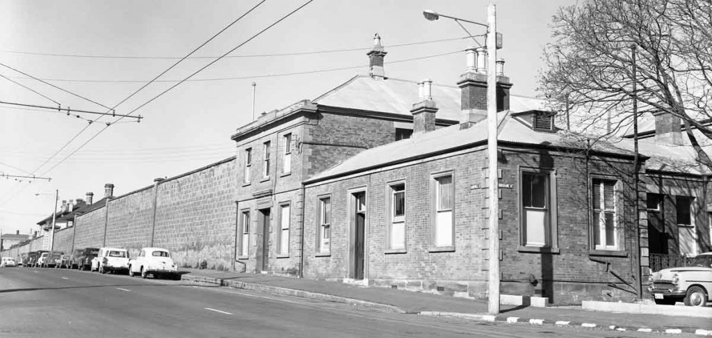
Old Hobart Gaol 1960’s. Courtesy of the Archives Office of Tasmania No AB713-1-7988
Underground tunnels were built to connect the gaol to newly built courtrooms. The size of the gaol expanded over time as demand required.
Stories of cruel treatment and unsuitable conditions were common and Campbell St. Goal became one of the most dreaded prisons on Van Diemen’s Land. This prison was also one of the few penal locations where executions took place.
The building continued to serve as a prison until 1960 where male prisoners were shifted to the newly built H.M Risdon Prison in 1961 and female convicts were transferred to Risdon Female Prison in 1963.
Sadly, much of the original high-security prison structure was demolished, however the remains of the chapel and some colonial cells can be explored in a guided tour of the location. Visitors can take guided tours of the Penitentiary Chapel Historic Site during day or at night to get to know the history of the place and the interesting stories associated with it.
Cascade Female Factory
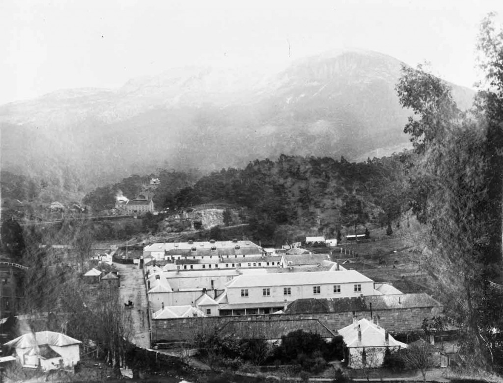
The Cascade Female Factory, Hobart. Post 1870. Image courtesy of The Archives Office of Tasmania. No NS1013/1/45
Address: 16 Degraves Street, South Hobart, 7004
In colonial times, most female convicts were kept in female-only penal stations called ‘female factories’. The Cascade Female Factory, located in South Hobart, received the greatest number of female convicts transported to Van Diemen’s Land. The factory operated from 1828 to 1856 and served as a prison till 1877.
Original plans for the Cascade Female Factory consisted of a single yard containing a kitchen, hospital and nursery but as demand expanded, four more yards were added to the complex.
The Cascade Female Factory often came under criticism due to the inhuman treatment of inmates and unhygienic conditions that led to the too-frequent deaths of infants and newborn.
The Factory became a picture of neglect after it ceased to operate in 1877. Its sandstone walls and garden have been restored is now an officially recognised heritage site. Visitors can take a self-guided tour of the grounds or can join a guided Heritage Tour to fully experience the dark and troubled stories this location has to tell.
Cascade Brewery
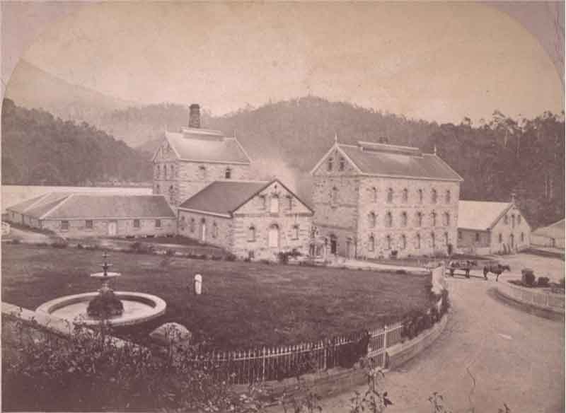
Cascade Brewery, Hobart c1880. Image courtesy of the W.L. Crowther Library,Tasmanian Archive and Heritage Office
Address: 140 Cascade Road, South Hobart
The Cascade Brewery was established in 1832 and holds the distinction of being the oldest running brewery in Australia. The brewery was co-founded by British Army Major Hugh Macintosh and ex-convict Peter Desgraves, and remains a fully-functional brewery servicing local and international demands.
The brewery is housed in an iconic 19th century building located near the base of Mount Wellington, and features an on-site museum showcasing the journey of the brewery ever since its creation next to a small mountain stream, the Hobart Rivulet.
The brewery offers tours lasting approximately 90 minutes where the process of brewing and bottling the state’s iconic beer are demonstrated.
A stroll through the nearby heritage Woodstock Gardens is a refreshing experience. Spread over three acres, this landscape garden can be considered the best beer garden in Australia.
Other interesting activities at the Cascade Brewery include the 2.4 km long Cascade Walking Track. This scenic track begins from Cascade Brewery and ends at the base of Mount Wellington. There is also a gift shop where visitors can buy souvenirs, accessories and of course… beer. Learn more here.
Click here to see our range of DVDS available for purchase featuring Tasmania’s History.
Royal Tasmanian Botanical Gardens
The Royal Botanical Gardens, Hobart. Date not known but likely late 19th Century. Image courtesy of the Tasmanian Archive and Heritage Office. No PH30-1-157.
Address: Lower Domain Road, Queens Domain, 7000
Another historical jewel in Hobart’s crown is the Royal Tasmanian Botanical Gardens (also known as ‘RTBG’). The RTBG was established in 1818 and is spread over an area of 14 hectares in an area of Hobart called the Queen’s Domain. Initially, the gardens were the lieutenant- governor’s private area and very few people were allowed to visit it. Over the years the garden expanded as local and imported plants were added to it.
The Garden boasts of a number of unique and rare plants with many dating back to the nineteenth century and is the only garden in the world to feature the Subantarctic plant house. History lovers can appreciated the Arthur’s Wall (1829), Superintendent’s Cottage, the Conservatory and the Eardley-Wilmot Wall, one of the longest convict-built structures in Australia. The peaceful gardens can be visited almost every day of the year.
The Hobart Zoo
Address: Queen’s Domain, Glebe, Hobart
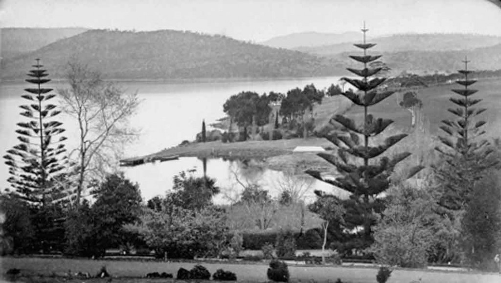
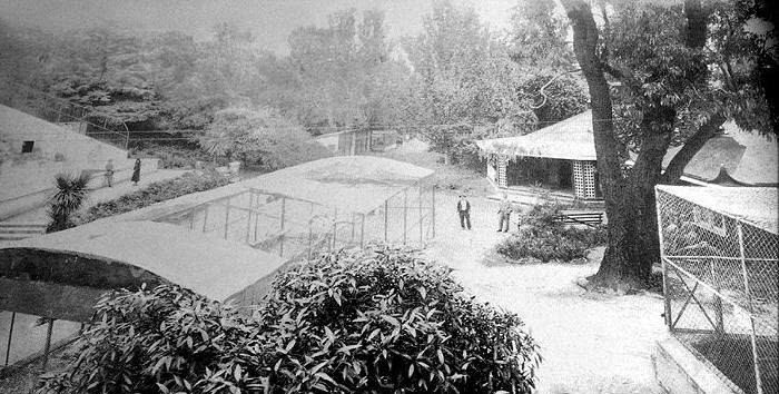
The defunct Hobart Zoo is another historically significant location in the Queen’s Domain. Also known as the ‘Beaumaris Zoo’, the location was established in 1895 at the residence of Mrs. Mary Grant Roberts, a pioneering Tasmanian Devil breeder.
On her death in 1921, Mrs. Roberts’ family offered her animal collection of 200 species of birds, reptiles, mammals and marsupials to the state government. In 1922 the Hobart City Council graciously accepted the gift and formed the Zoo. This location is where the last remaining captive Tasmanian Tiger (the ‘Thylacine’) died.
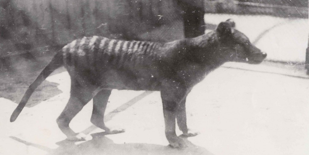
Tasmanian Tiger (Thylacine) at Hobart Zoo. Date unknown. Image courtesy of the Tasmanian Archive and Heritage Office. No NS434/1/63
Over the next fifteen years, various species of animals and birds were brought to the zoo from all over the world, however in 1937 the Hobart Zoo was closed for good due to lack of finances. Sadly, not much of the zoo remains today. The pond area and a few enclosures can be seen throughout the grounds and unfortunately public tours are not available.
Click here to buy our featured “Tasmanian Tiger” DVD and see other available Tasmanian DVDS.
Government House
Government House between 1870 and 1890. Courtesy of Allport Library and Museum of Fine Arts and the Tasmanian Archive and Heritage Office
Address: 7 Lower Domain Road, Hobart, 7000
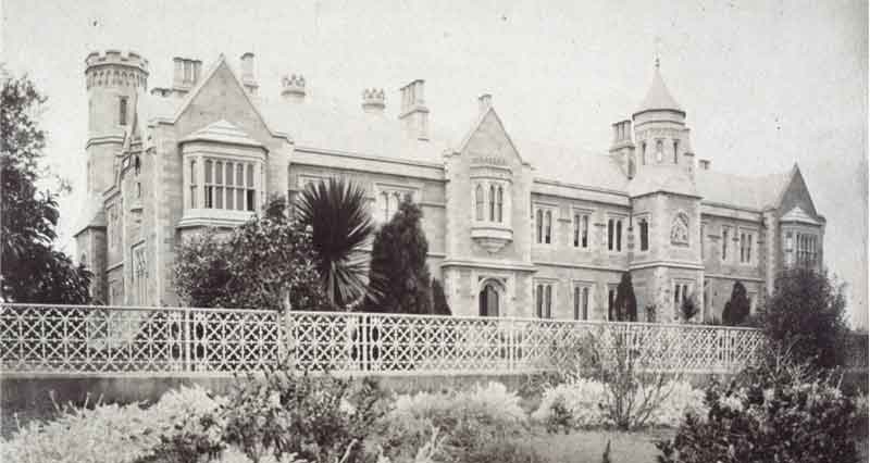
Government House is an iconic sandstone building on the western shore of Hobart and is the official residence of the Governor of Tasmania. Under the command of architect William Pordon Kay, construction of the Tudor-Gothic building began in 1855 and took two years to complete.
The 73 roomed palatial house spreads across 15 hectares and features three tennis courts, stables and staff cottages as well as an impressive traditional ‘period’ garden. Sandstone was extensively used in the construction process, and teak and cedar from old ships feature throughout the building. The interior is lavishly decorated with paintings, antiques, sculptures, gold-edged wall mirrors, grand pianos and chandeliers.The exterior is made from equally impressive stonework, intricately carved chimney pots made from sandstone and crenellation, gargoyles and bas-relief sculptures. This building is one of the finest and most majestic vice regal residences in Australia.
On 2nd January 1858, Sir Henry Fox Young was the first governor to take up residence in this elegant Government House. Since then, twenty-seven governors (including the present Professor Kate Warner) have taken up residence in Government House. The most interesting fact about the house is that no renovation work has been done on it although in 1991 the Conservatory was rebuilt following the original plans. Some of the grandest rooms in the House are open for public including the Ball Room, the French Room, the Dining Room, the Ante-Drawing Room, the Drawing Room, the Main Hall and the Conservatory.
Anglesea Barracks
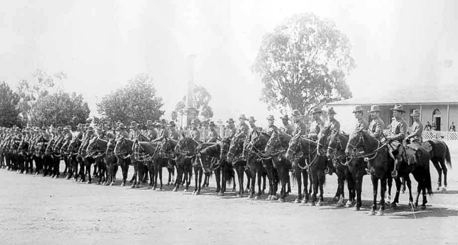
Anglesea Barracks, Hobart- soldiers on horseback. Tasmanian Bushman’s Contingent for Boer War. Courtesy of the Tasmanian Archive and Heritage Office. No PH30-1-5652
Address: Davey St, Hobart, 7000
Located on Davey Street, Anglesea Barracks is the oldest military establishment in Australia and consists of multiple colonial buildings.
In Hobart Town’s early days, a strong military presence was required to handle the growing number of convicts being sent from Europe. In 1811, Colonel Lachlan Macquarie selected the perfect spot for the accommodation of troops atop a small hill, now known as Davey Street. Macquarie ordered barracks to be built along with a hospital and quarters for married officers. The construction of the barracks was completed in 1818, and a military prison was added to the barracks in 1847. Governor George Arthur named the barracks Anglesea Barracks after the Master General of the Ordnance in England, the Marquis of Anglesey. The barracks served as the Headquarters of the British Imperial Army until the stationing of the last British regiment in 1870. From this time onwards, only a small portion of the barracks remained under military control.
When Australia became a Federation in 1901, the military regained the total control of Anglesea Barracks until today functions as a military recruiting and training facility. The barracks have been largely restored and the prison converted into a military museum. Both the external grounds and the interior of the barracks are open for public tours and a guided tour of the interior is offered once a week. Visitors to the barracks can walk around the old drill hall, hospital, quarters of the married officers and a museum where objects from the colonial era and various conflicts are displayed.
Eaglehawk Neck

Eaglehawk Neck. Date unknown. Courtesy of the Tasmanian Archive and Heritage Office. No PH30-1-1829
Directions: Around 1 hour drive from Hobart along the Tasman Highway to Sorrell. Turn right onto the Arthur Highway to Eaglehawk Neck. Distance is approximately 76 kms.
Located an hour’s drive south of Hobart is Eaglehawk Neck, a narrow strip of land connecting the mainland of Tasmania to the Tasman Peninsula (home of Port Arthur, the state’s most notorious colonial convict prison). This unique geographic formation meant any form of transit in and out of the peninsula could be controlled, and made for a suitable line of protection against escaped convicts.
A military station was constructed in 1832 to protect the area and to make the ‘Neck 100% secure from escaping convicts. A row of guard dogs was chained across the span of the neck, and was used to alert sentries to any sounds they heard. This ‘dogline’ is remembered today by a bronze structure of a dog, a lamppost and a barrel. The military station now serves as an Officers’ Quarters Museum.
Besides its historical value, Eaglehawk Neck is also famous for its unusual natural features like the Tessellated Pavement, Tasman’s Arch, and Devil’s Kitchen. The Tessellated Pavement is an area of flat rocks that looks more like a man-made feature than the work of nature. The Tasman Arch is a natural bridge formed by the cliffs while the Devil’s Kitchen is a deep cavern formed by the pressure of the furious foaming waves.
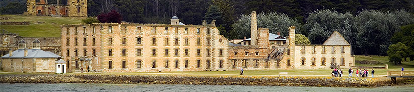
Port Arthur
Port Arthur ca.1866. Courtesy of the Allport Library and Museum of Fine Arts, the Tasmanian Archive and Heritage Office.
Directions: Around 1 hour 20 minutes drive from Hobart along the Tasman Highway to Sorrell. Turn right onto the Arthur Highway to Port Arthur. Distance is approximately 95 kms.
The historic site of Port Arthur is one of Tasmania’s most recognised landmarks and draws hundreds of thousands of visitors every year. Officially Tasmania’s top tourist attraction, Port Arthur is an hour’s drive southeast from Hobart.
In 1833, Port Arthur became a penal colony for repeat offenders and those convicted of serious crimes. Brute force and cruel punishments were used to discipline convicts and as a result Port Arthur quickly gained a notorious reputation. Until it’s closing in 1877, more than 12,000 convicts served sentences in Port Arthur.
Many of the historic buildings on the site are fruits of convict labour. Notable buildings include the penitentiary, the spooky model prison, the parsonage and the Commandant’s residence.
The historic site of Port Arthur has become an icon of Tasmanian tourism and draws visitors in large numbers every year. A visit to Port Arthur is not complete without a chilling ghost tour or paranormal experience of the supposedly haunted historic site.
Saltwater River
Saltwater River Coal Mines station from Mt Lepus. Date unknown. Courtesy of the Tasmanian Archive and Heritage Office. No PH30-1-4573
Directions: 1 hour 35 minutes drive from Hobart along the Tasman Highway to Sorrell. Turn right onto the Arthur Highway to Taranna past Eaglehawk Neck. Turn right at Taranna onto Numeena Rd to Premaydena and then right onto Saltwater River Road. Distance is approximately 102 kms.
Saltwater River is a set of convict ruins situated 25 minutes drive south of Port Arthur. Operating alongside the main settlement at Port Arthur, this small penal colony consisted of two outstations: an agricultural farm where food was grown and supplied to Port Arthur, and the coal mines, a secondary and much harsher outstation reserved for repeat offenders. Saltwater River was the first operational coal mine in Tasmania and was functional from 1833 till 1848. The coalmines were known to the convicts as ‘Hell on Earth’.
At its peak, the Saltwater River colony held around five hundred convicts who toiled in very poor conditions. Unruly offenders were harshly punished, flogged and kept in solitary confinement. In many cases prisoners were made to spend thirty days in a cell with no light. The ruins of Saltwater Creek include a chapel, barracks and other sandstone residences. Considered a hidden historical gem, Saltwater River is the location often only known to locals. Best explored on foot.
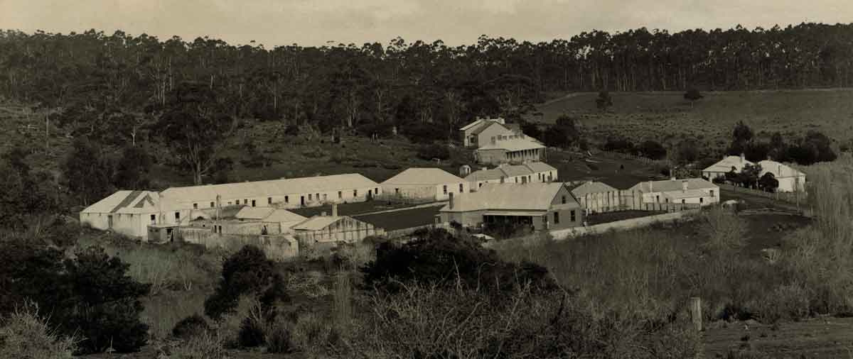
The Willow Court Asylum
The Willow Court Asylum at New Norfolk. Courtesy of the Tasmanian Archive and Heritage Office. No PH30-1-5093
Address: The Avenue, New Norfolk, Tasmania
Directions: Around 35 minutes drive from Hobart. Head north on the Brooker Highway, and continue on the Lyell Highway towards New Norfolk.
The Willow Court Asylum was Australia’s first mental asylum and also the oldest continuously running asylum until its closure in the late nineties. Locally known as ‘Willow Court’, the estate was constructed in the early 1800s and received its name from the two willow trees planted in a central courtyard by the wife of Lieutenant-Governor John Franklin, the governor of Van Dieman’s Land. The willows are said to have originated from cuttings taken from the grave of Napoleon.
The very first building of the complex was built by Colonial Architect John Lee Archer and is know as the ‘The Barracks’. In its initial stages, The Barracks was a two-room building designed to house invalid convicts and those deemed to be mentally unstable (known in the period as ‘lunatics’). As the convict population grew, the building became inadequate and expansion began in 1830. Over time, the newer buildings consisted of separate wards for male and female invalids, offices, a chapel, and accommodation for the Medical Superintendent, surgery, dispensary, morgue and storerooms. A plot of 4 acres for a vegetable garden was also allotted to the asylum. Over the years the name changed to The New Norfolk Hospital for the Insane and concluded as The Royal Derwent Hospital.
The Tasmanian government’s deinstitutionalization initiative the led to the gradual closure of the 170 year old hospital. Older buildings were added to the Tasmanian Heritage List but suffered due to negligence, vandalism and compounding disrepair. A large part of the area is now under private ownership and serves as venues for various local businesses.
Over the years thousands of Tasmanians were incarcerated in the asylum as patients. This is now of great genealogical interest for those researching Tasmanian and Family History.
Maria Island
Maria Island-The Settlement. Date unknown. Courtesy of the Tasmanian Archive and Heritage Office. No NS1029-1-340
Directions: From Hobart, take the A3 to Sorell and continue to the ferry at Triabunna. There are two ferries: one in the morning and one in the afternoon.
The charming and secluded Maria Island lies on the east coast of Tasmania, approximately 88km north east of Hobart. Although the island is rich in flora, fauna and geographic features, most of the interest in Maria island comes from rich convict and Aboriginal history.
Maria Island was established as Tasmania’s second earliest penal settlement in 1825. The station was abandoned in 1832 because, compared to the other penal stations in Tasmania, discipline was a little too relaxed and there were many attempts to escape. All of the convicts at Maria Island were relocated to the Port Arthur penal station. Some of the ruins of this period are a barracks, a commissariat, a penitentiary and remains of a cemetery.
A little while later, Maria Island was revisited as a convict station and two probation stations were set up: one at Darlington and the other at Point Lesueur. Old buildings were altered and some new structures were built to accommodate six hundred convicts. However this arrangement too did not last long and in 1851 Maria Island permanently ceased to be a penal station. The ruins of this second convict period include a cottage, mill foundations, a mess hall, a convict barn and an oast house.
Realizing the natural and historic importance of the island, Tasmanian authorities declared the island a National Park. Maria Island is a major tourist attraction and offers a number of activities and opportunities to enjoy Tasmania’s wilderness at its best.
Oatlands
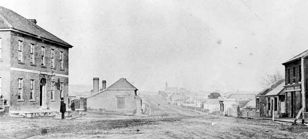
Oatlands township – view along Main Road. Courtesy of the Tasmanian Archive and Heritage Office. No PH30-1-8963
Directions: Drive north from Hobart on the Brooker Highway, turning onto the Midlands Highway. Time from Hobart is just over an hour with a distance of approximately 84 kms. From Launceston, drive south on the Midlands Highway. Time from Launceston is approximately 1 hr 25 minutes, with a distance of approximately 115 kms.
Due to its strategic location approximately halfway between Hobart and Launceston, Oatlands was established as a base for controlling and administrating convicts. It was not exclusively a military base and over time it grew into a prosperous town due to the combined effort of convicts and free settlers.
The town has a number of historical, convict made buildings styled in Georgian architecture. Among these important historic buildings is the Oatlands Courthouse, originally constructed as a police station and a chapel in 1829. The oldest Supreme Court courthouse in Australia is also situated here.
The old gaol situated behind the Courthouse was constructed in 1835 and for a century served as a military and state prison. In 1937 much of the building was demolished and what visitors can see today are the ruins of the walls and the gaoler’s residence.
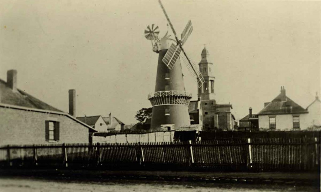
Callington Mill is Oatlands’ most widely recognised ‘trademark’ windmill. This windmill was built in 1837 by John Vincent and over a number of decades gradually ceased to operate. After being recently restored, the mill is now fully operational and is the only one of its kind in the Southern hemisphere.
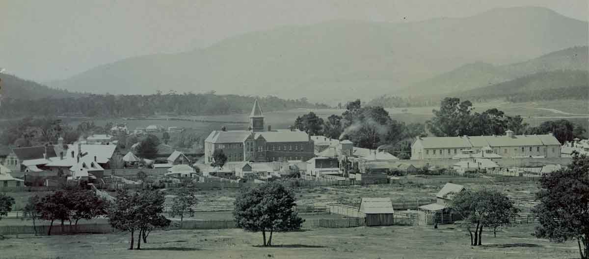
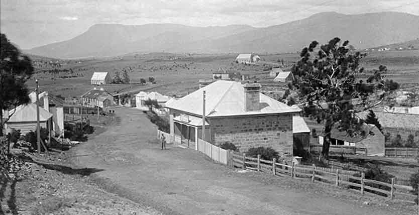
Hamilton
Side-on view of the Council Chambers at Hamilton. Date unknown. Courtesy of the Tasmanian Archive and Heritage Office. No PH30-1-745
Directions: Head north on the Brooker Highway and turn onto the Lyell Highway. Distance is approximately one hour or 73 kms from Hobart.
Originally called Sorell Plains by Governor Macquarie, the area of Hamilton was renamed in 1826 after a wealthy free settler by the name of William Henry Hamilton.
According to historians, Hamilton was first occupied by the Pangerninghe tribe of Aborigines. European settlers arrived in 1807, and by 1844 the settlement of Hamilton had grown into an important and prosperous town with six inns, two breweries, stone quarries, mills, a blacksmith and a large probation station for convicts. Most importantly, it had become a transport hub for the wider region.
Over the years Hamilton lost its importance as a commercial hub but kept the charms of the quaint township it was in 1840s. Hamilton’s St. Peter’s Church (1834) is one of the oldest churches in Australia and was built with a single door to prevent convicts in the congregation from escaping. In 1835, Hamilton got its Post Office and in 1840 the accommodation for clergy known as McCauley’s Cottage was built. A residence for the gaoler, known as the Warder’s Cottage, was also constructed. The Warder’s Cottage now houses the Historical Society’s Heritage Centre and Museum.
Pontville
Pontville – from the Post Office looking south. Date unknown, Courtesy of the Tasmanian Archive and Heritage Office. No PH30-1-594
Directions: Head north from Hobart on the Brooker Highway, and turn onto the Midlands Highway. Distance is 27 kms from Hobart.
Pontville began its rich and significant life as a garrison town in 1821 and later became known for its timber and stone production. The town quickly became the biggest supplier of the latter in the entire southern region, and due to this economic activity boasts some classic convict structures that still survive to this day.
One of the earliest convict buildings built was the Officer’s Mess (1820) which, in 1861, became the Pontville Post Office. Lythgo’s Row, a series of white cottages built to accommodate soldiers, is one of the landmark buildings of Pontville and is also known as the Barracks. Many privately owned historic buildings in Pontville have been converted into historic accommodation.
Kempton
Kempton – view down Main Street. Photo dated between 1860 and 1922. Courtesy of the Tasmanian Archive and Heritage Office. No PH30-1-247
Directions: Head north from Hobart for 40 minutes on the Brooker Highway, turning off at the Midlands Highway. Distance is approximately 48 kms from Hobart.
Kempton’s location en route from Hobart to Launceston first gained the attention of European settlers in 1814, and originally held the name of Green Ponds. In 1816, a soldier-merchant by the name of Anthony Flenn Kemp arrived in the town to later become a pioneer of the wool industry in Tasmania. His influence on the town was so strong that in 1840 it was renamed ‘Kemp Town’, which later became Kempton. Many other free settlers arrived in the area during the 1820s and acquired land grants to take up farming.
In 1828 a military station was established at Kempton on the orders of Governor Arthur. In 1834 a convict probation station was established at The Glebe, however in 1841 was converted to a police station. The cottage of the Superintendent, which was a part of the probation center, was constructed in 1837 and is presently serving as the Southern Midlands Council Kempton offices.
The town prospered and eventually a brewery, a flour mill, shops, general stores and workshops of blacksmiths, ostlers and wheelwrights were established.
Although the modern Heritage Highway bypasses this historic town, Kempton still welcomes visitors with food and accommodation in old, privately owned coaching inns. With several convict-built structures to explore, peaceful environment and natural features, Kempton is a beautiful little town full of rich colonial history.
Campbell Town
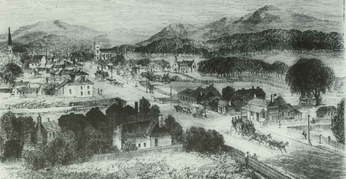
Early Campbell Town. Date unknown. Courtesy of the Tasmanian Archive and Heritage Office. No PH30-1-1138
Directions: Head North from Hobart for 1 hr 25 minutes drive on the Brooker Highway and the Midlands Highway. Distance is approximately 130 kms from Hobart. Head 50 minutes south from Launceston on the Midlands Highway. Distance is approximately 69 kms from Launceston.
Campbell Town is one of the four original garrison/military towns set up between Hobart and Launceston and today stands as a busy throughway for Tasmania’s busiest north-south highway. The rich colonial history of the town can be seen in the period buildings and convict-built structures across the town.
With the introduction of Saxon-Merino sheep in 1830s by Eliza Forlonge, Campbell Town quickly became a centre of Tasmania’s fine wool industry. Later, the community expressed its appreciation of the Lady Forlonge’s efforts by erecting a statue in her honour.
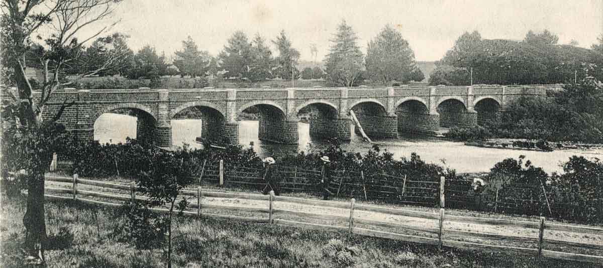
The town’s Red Bridge is a fine example of convict-built masonry and was constructed between 1836 and 1838. Built with more than a million handmade bricks, the bridge has three arches and is the oldest of its type in Australia. The Old Bridge, constructed over the Elizabeth River in 1822, and the Black Bridge, that linked the railway line to the east end, are two other examples of Campbell Town’s marvellous convict stonework.
Other historical buildings in the town are the Campbell Town Inn, the Campbell Town Hospital (1839), St. Luke’s Sunday school, St. Luke’s Anglican Church and a host of other private houses and manors. Popular among these is the Foxhunters Return (1833), a coach inn regarded as one of the finest hotels of its time. The Inn’s cellar once housed a convict labour-gang and is now a bookshop.
Another interesting feature in the centre of the town is the Convict Brick Trail, a structure comprised of over 2000 bricks set into the pavement. The trail contains the names and brief personal details of each convict transported to the area.
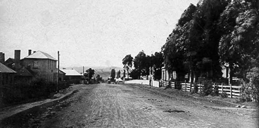
Perth
Bridge at Perth. Date unknown. Courtesy of the Tasmanian Archive and Heritage Office. No LPIC147-1-183
Directions: Drive 1 hr 50 minutes north from Hobart on the Brooker Highway and Midlands Highway. Distance is approximately 180 kms from Hobart. From Launceston, drive 15 minutes drive south on the Midlands Highway. Distance is approximately 18 kms.
The town of Perth was founded in 1821 when Governor Macquarie established a military post and an Inn about 18 kilometres south of Launceston. Flourmills, residences, school and a convict station were built as the town grew.
Perth has a number of Victorian and Georgian buildings dating back to the nineteenth century. Some of Perth’s most significant buildings were two old Inns: The Leather Bottle and The Jolly Farmer. The Leather Bottle Inn (1830) is now an antique shop and the Jolly Farmer (1826) is now a private residence.
The octagonal shaped Baptist Church was built in 1889 and is admired for its impressive Romanesque Revival-style architecture. Another attractive building in Perth is Eskleigh Home. This double storey Victorian Mansion was built in the 1870s as a private residence, however after the death of the owner, was converted into a care home. There are many other old buildings and residences with interesting stories in the township of Perth.
Launceston
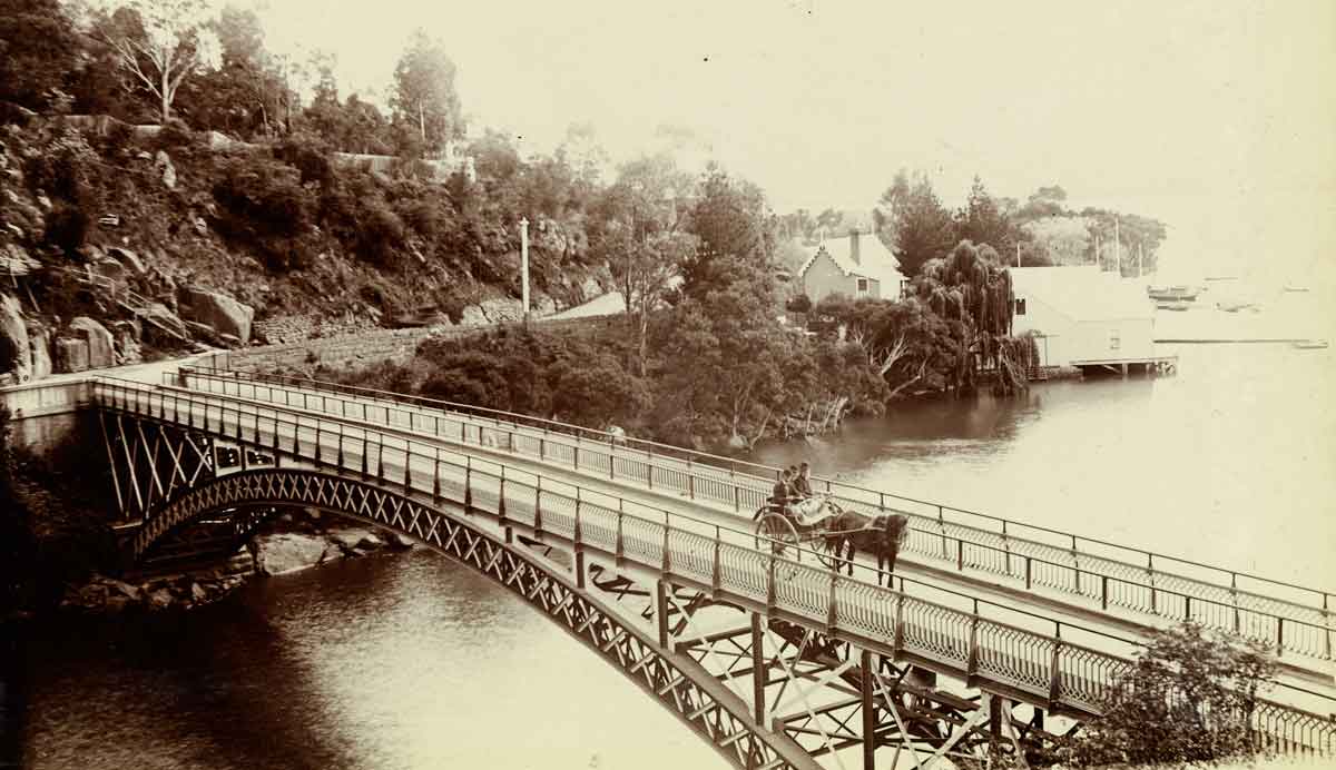
Cataract Bridge at Launceston. Photo dated 1891 – 1899. Courtesy of the Tasmanian Archive and Heritage Office. No LPIC22-1-60
Directions: Drive 2 hrs 15 minutes drive north from Hobart on the Brooker Highway and Midlands Highway. Distance is approximately 200 kms.
Launceston was established in 1806 when soldiers, free settlers and convicts were transferred from their settlement in York Town. The town was named after Launceston in Cornwall, England.
Launceston Wharves. Date unknown. Image courtesy of the Tasmanian Archive and Heritage Office. No PH30-1-9173
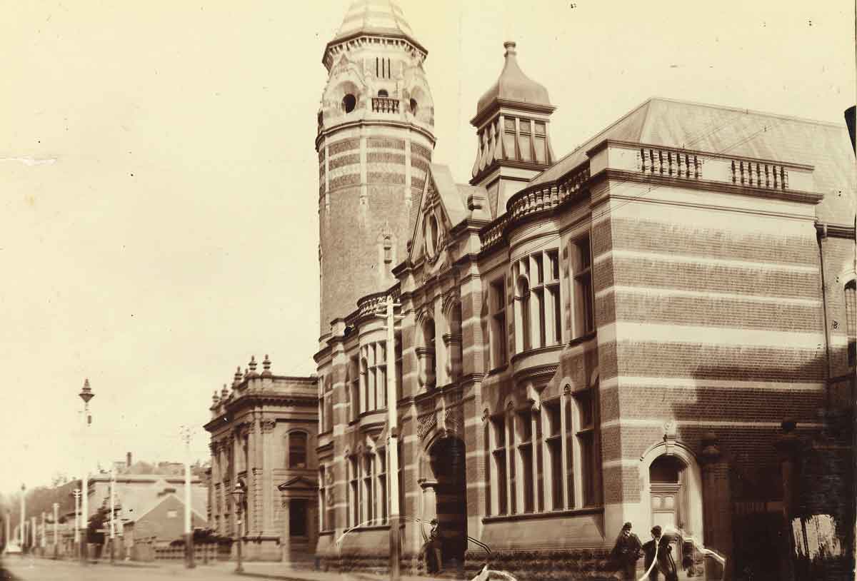
Launceston’s colonial buildings are some of the most preserved across the state, with some dating back to 1824. The most prominent historic building in Launceston is Paterson Barracks. Constructed in 1830, the Barracks is considered to be one of the best-preserved brick buildings of the colonial era.
Launceston Post Office between 1891 and 1899. Image courtesy of theTasmanian Archive and Heritage Office. No LPIC22-1-52
The Post Office was built in 1880 as part of the impressive public buildings found on St. John’s Street. Launceston’s ‘female factory’ female prison operated from 1834 till 1855, but was closed and later demolished to establish the Launceston High School. The Old Umbrella Shop in George Street (1860’s) is one of the last surviving 19th century shops in Tasmania, and elegant buildings such as the Customs House and The Old Bank are proof of Launceston’s early prosperity. The historic building of Morton House (previously St. John’s Hospital) is the site of Australia’s first medical operation under general anaesthesia. St. John’s Church (1824) is another building with historical significance in Launceston.
Hoblers Bridge in early Launceston. Photograph dated between 1891 and 1899. Now the Newstead area of Launceston. Image courtesy of the Tasmanian Archive and Heritage Office. No LPIC22-1-50
Click here to see our range of DVDS available for purchase featuring Tasmania’s History.
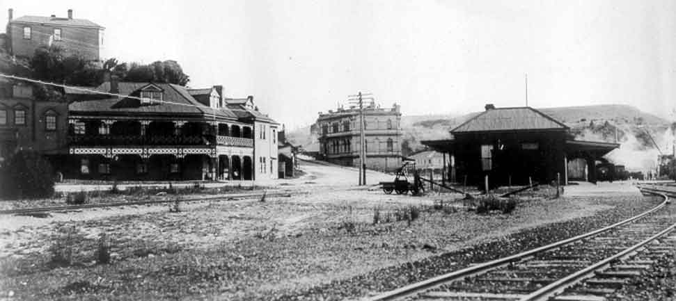
Queenstown
Early Queenstown. Date unknown. Image courtesy of the Tasmanian Archive and Heritage Office. No NS479-1-80
Directions: Drive 3 hrs 30 minutes drive north from Hobart on the Brooker Highway and Lyell Highway. Distance is approximately 259 kms. From Launceston drive 3 hrs 30 minutes drive west on the Bass Highway to Burnie and then south on the Ridgley Highway. Turn left onto The Murchison Highway and travel through Rosebery. Then left onto The Zeehan Highway to Queenstown. Distance is approximately 260 kms.
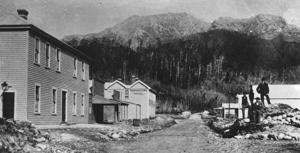
Queenstown, located in the Queen River Valley on the western ranges, best represents Tasmania’s early industrial heritage. The west-coast ranges of Tasmania were initially explored in 1862 and after a few years, gold deposits were discovered at Mount Lyell. In the 1890s a large deposit of copper was discovered which led to the establishment of a number of mining sites in and around the township of Queenstown. The town was officially established in 1897 and was named after Queen Victoria.
The growth of the town progressed with the growth of the local mining industry: churches, schools, hotels, residences and even theaters flourished around the township. Over the decades to follow the town lost its industrial significance, however it managed to retain a beautifully accurate architectural heritage.
Many streets in Queenstown present a Victorian streetscape and many period buildings exist in their original form. Some of the most significant buildings are the Queenstown Post Office, St. Joseph’s Catholic School (1899), The Empire Hotel, and Hunter’s Hotel which still operates today.
The Queenstown Railway Station was renovated and now houses the must-see West Coast Wilderness Railway attraction, a lovingly resorted rack-and-pinion steam railway that travels through ancient rainforests through to the coastal town of Strahan. The complete history of Queenstown can be seen in the Galley Museum, and the recently renovated Paragon Theater is also worth a visit.
Click here to buy our featured “West Coast Wilderness Railway” DVD and to see our other available Tasmanian DVDS.
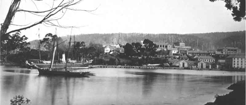
Strahan
Early Strahan. Date unknown. Image courtesy of the Tasmanian Archive and Heritage Office. No PH30-1-6996
Directions: From Hobart, drive 4 hrs drive north on the Brooker Highway and Lyell Highway. Distance is approximately 300 kms. From Launceston, drive 4 hrs drive west on the Bass Highway to Burnie and then south on the Ridgley Highway. Turn left onto The Murchison Highway and travel through Rosebery. Left onto The Zeehan Highway to Queenstown and then The Lyell Highway to Strahan. Distance is approximately 300 kms.
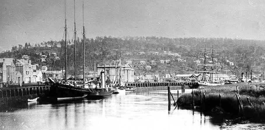
The town of Strahan is located on the rugged west coast of Tasmania. Located at the north end of Macquarie Harbour, Strahan came into being in 1883 and was named in the honour of Governor George Strahan.
When the mining industry in Queenstown and adjacent areas started to explode, a port was needed to export extracted minerals. A rail line from Queenstown to Strahan was built (now The West Coast Wilderness Railway) and Strahan soon developed into a small but busy port. Strahan also became an important centre for the Huon Pine industry.
One of the finest examples of Strahan’s grand Victorian architecture is Customs House. Built in 1900, it was used as an office by a number of government departments. Many of the original timber fittings can be seen here, including the Blackwood and Huon Pine counter. The single story Bond Store, although not as grand as the Custom House, currently serves as a community hall. Elaborate timber grave markers can also be seen in the Strahan Cemetery where the pioneers of the earliest inhabitants of the town lay to rest.
Strahan today is predominantly a tourist town. One of Tasmania’s premier tourist destinations, the award winning Gordon River Cruises enables visitors to experience the incredible scenery of the World Heritage Area here and other iconic areas of Macquarie Harbour.
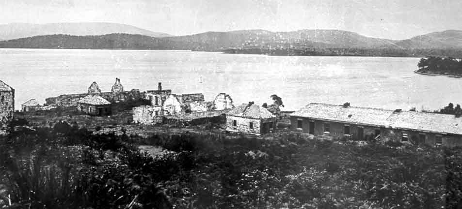
Macquarie Harbour Penal Station (Sarah Island)
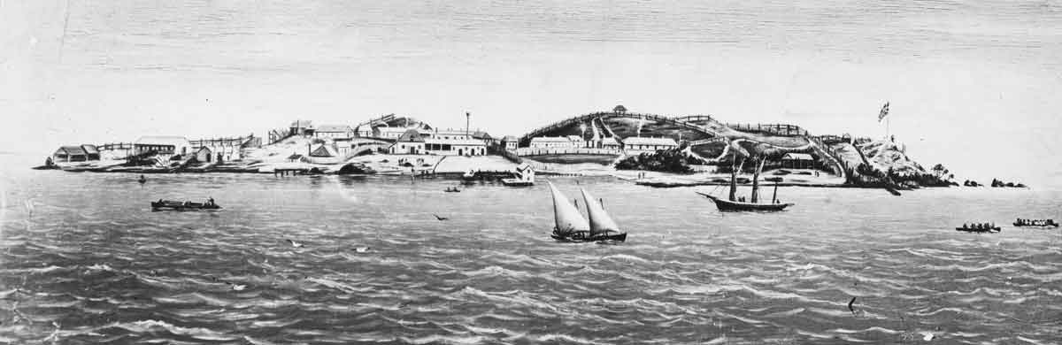
Sarah Island as a penal settlement. Date unknown. Image courtesy of the Tasmanian Archive and Heritage Office. No NS1013-1-1866
Directions: Visited as part of the Gordon River Cruises tour.
The Macquarie Harbour Penal Station was established in 1822 and was reputed to be one of the harshest penal stations in Tasmania. Flogging, hard labour and solitary confinement were frequent punishments and living conditions were so poor that many murders were committed in order to escape.
The main penal settlement was situated on Sarah Island, a remote outpost in Macquarie Harbour. The island was chosen because of its geographical ‘security benefits’ – the island is fiercely guarded by rough seas, inhospitable wilderness and the terrifying winds of the Roaring Forties. Convicts were used to obtain timber from the surrounding wilderness for the purpose of shipbuilding.
The settlement was closed after 11 years in 1833, and convicts were sent to the newly constructed Port Arthur. From this time, the island was largely neglected and some of the buildings were demolished in the late nineteenth century to obtain materials for construction. The remaining ruins hold an eerie testament to the terrible conditions suffered by the convicts. Interesting guided walking tours are held almost daily when visiting the island on a cruise of the harbour.